Story and images by Matthew Hassam
Chapter 1 – Day 1
Having arrived in Victoria fresh from spending two months exploring the wilds of Tasmania, I was keen to get back out into nature as soon as possible. But with one week left of summer school holidays I had to find somewhere a little off the beaten track to avoid the crowds that would no doubt be lingering anywhere within a stone’s throw of the coast; so where to go?!?
The Strzelecki Ranges, of course!
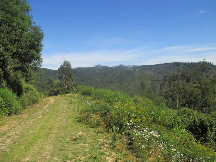
And I wasn’t about to let my lack of wheels get in the way, so after hopping off the coach from Melbourne in Yarram, I shouldered my 20kg+ backpack and headed for the hills. 2km down the road I stuck my thumb out for the first time, and sure enough the very next motorist passing by happened to be heading to his home about a dozen kilometres up the Tarra Valley Road and was happy to give me a lift. From there the scenery was already pretty impressive, so I put my legs to work and spent the next hour contentedly wandering up the road, as it crossed and re-crossed the Tarra River on it’s way up-valley, with only the occasional passing car to drown out the sound of the water rushing past. And no sooner had I stopped for a drink of water at a small roadside picnic area, than another friendly local pulled up to offer me a ride up the hill towards Balook – she even dropped me off right beside the free Pattison’s rest area that I’d been planning to stay at!
So after setting up my tent in a great little spot that was fully shaded for at least half the day, I made the most of my good fortune (having been prepared to walk the full 30km from Yarram to Balook, which wouldn’t have got me there until around 8pm) by following the delightfully quiet Grand Ridge Road the remaining 3km into Balook, where the visitor centre and it’s surrounding picnic area mark the start of a number of walking trails of varying distances.
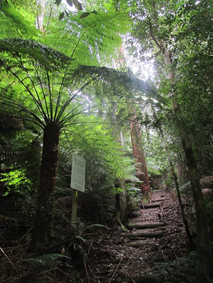
After starting out on the Lyrebird Ridge Track, I soon turned off onto the Ash Track, and had gone only a couple of hundred metres further when I spotted no less than four Superb Lyrebirds (two males and two females) on the track up ahead of me! Clearly they had taken a wrong turn and ended up on the wrong track, but I was glad to see them all the same, having never previously gotten a clear look at one of these birds… let alone four at once! Of course they scampered off into the bushes as soon as I approached too closely, but a companion of theirs who was well hidden no more than five metres from the track had no such qualms about carrying on his vocal performance in the company of strangers, to the delight of not only myself but an older couple who had joined me by this stage.
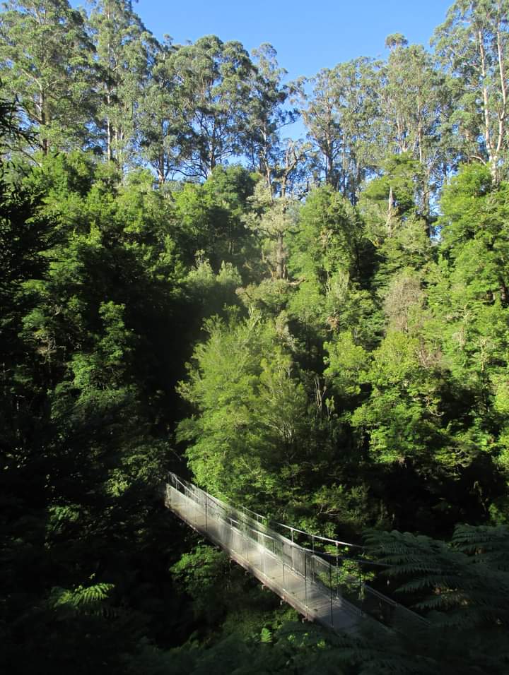
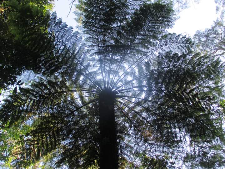
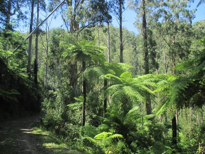
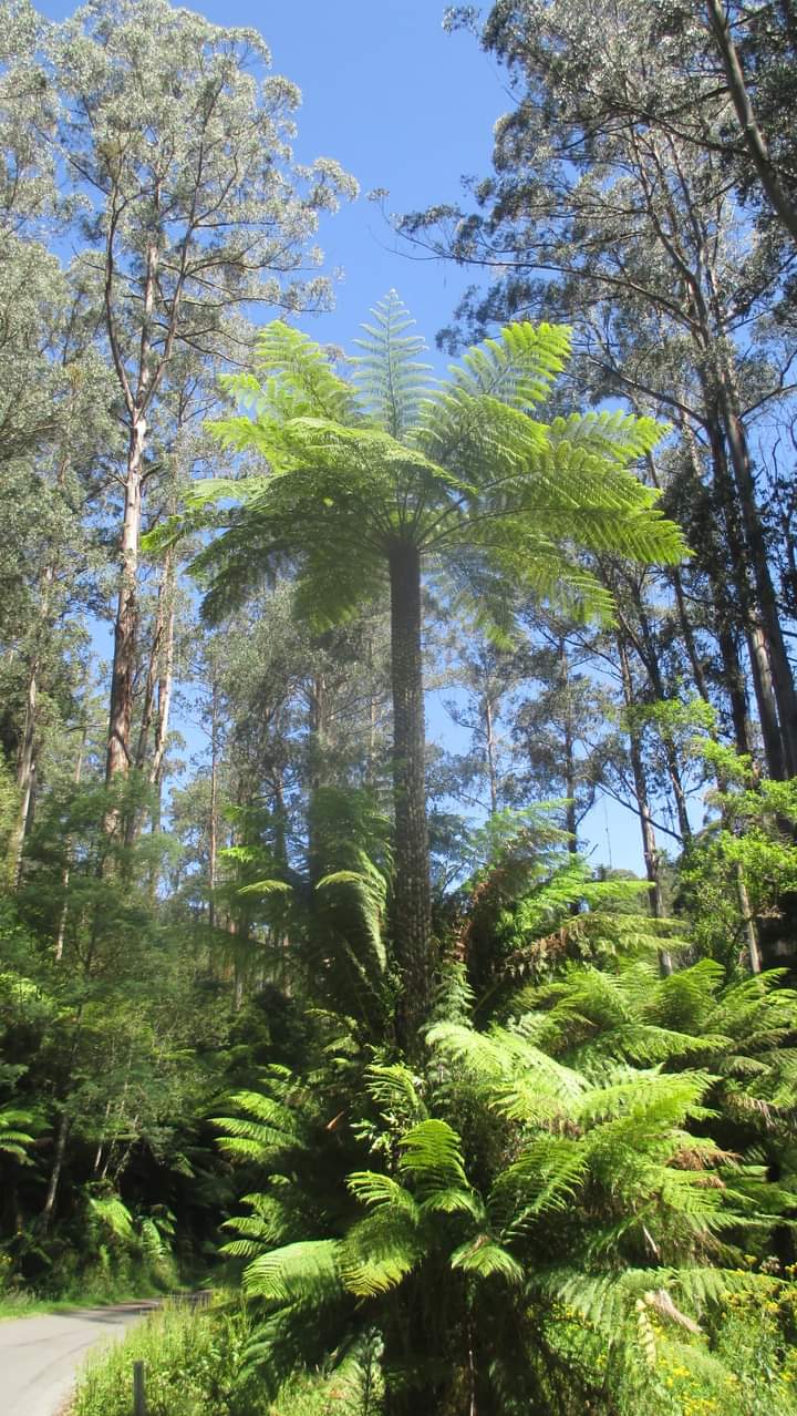
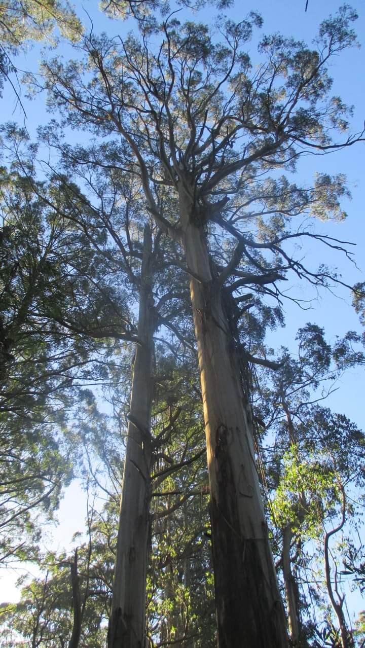
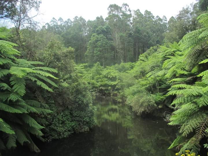
Eventually he quietened down, so I took my leave and continued on down the hill to the start of the Fern Gully Nature Walk, which first crosses the impressive Corrigan Suspension Bridge before looping around through the most wonderful fern-filled gully, watched over by countless majestic mountain ash trees soaring into the sky on either side.
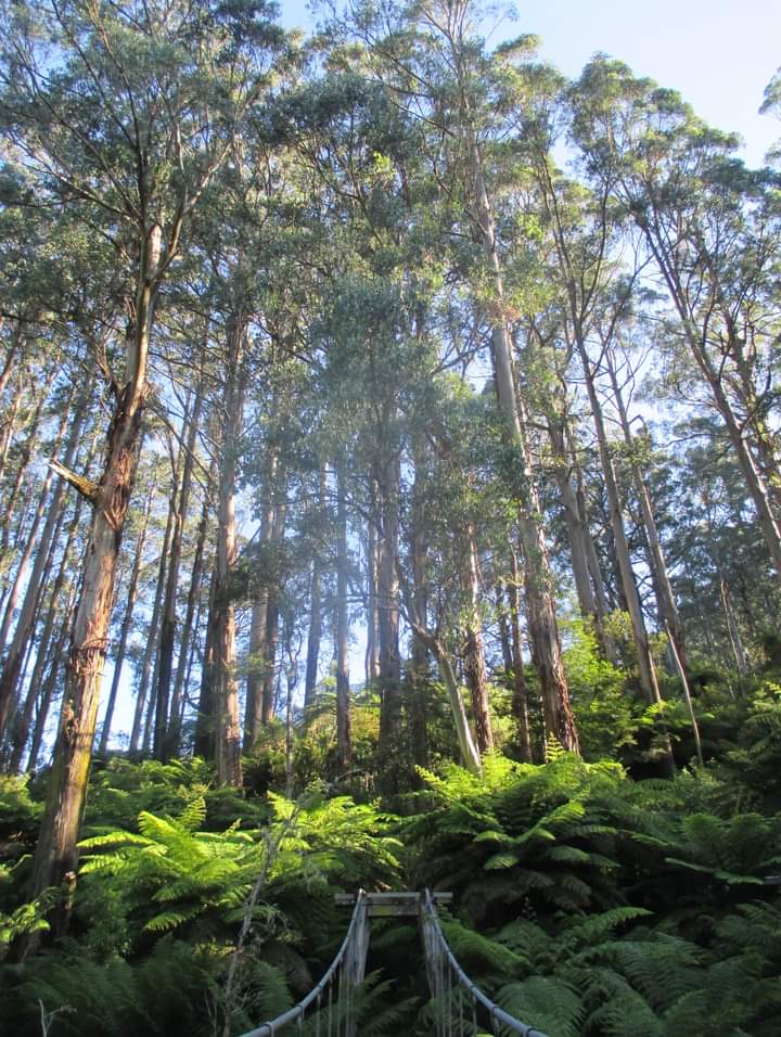
Having completed this smaller loop, I then re-crossed the suspension bridge and followed the well-named Scenic Track on a longer loop that brought me back to the visitor centre via the short Link Track. All in all it was a walk of no more than 4km yet had kept me enthralled for a good couple of hours, before I made my way back along Grand Ridge Road to my delightful little free campsite (complete with picnic table,
rainwater tank, rain shelter and compost toilet) accompanied by the sound of birdsong, as not a single car drove past to disturb the serenity.
And that was only day number one in the Strzelecki Ranges…
Chapter 2 – Day 2
For my second day in the Strzelecki Ranges, I headed back into Balook (again without a single car to dodge along the way) to tackle my first full-day loop on the Grand Strzelecki Track. This involved first re-tracing my footsteps from the previous evening along the Link Track, before crossing over the main Traralgon-Balook Road to make my way up through the forest on the Telecom Track, during which I found it beneficial to carry a fallen branch out in front of me to break the numerous spider webs that had been painstakingly woven overnight. That’s the problem with being 1.95m tall – even if you’re not the first person on the track that day, there’s a pretty good chance that no one who has come before you will have cleared away any of the spider webs much over 1.80m above the ground – which means that while the rest of you stays web-free, every single spider web that does cross your path is guaranteed to be at face height! Not how I generally prefer to start my day, hence the ‘spider web stick’.

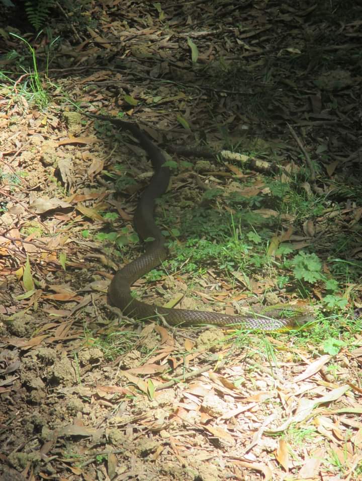
Of course an appropriately-sized fallen branch can always double as a ‘snake defence stick’, and it wasn’t long before this function was called into action along the tail-end of Drysdale Road, when a particularly curious (presumably tiger) snake decided it wasn’t too keen on giving up it’s precious basking spot, until a couple of gentle prods in it’s direction convinced it otherwise, at which point it did something I had never seen a snake do before: it lifted it’s head up off the ground and then plunged vertically straight down into an inch-wide hole in the ground that must have been at least a metre deep, as the entire snake disappeared before my very eyes! (Only later did I discover that the architect of this vertical burrow – and the thousands of others just like it that litter the surrounding hills – is a local species of crayfish!)
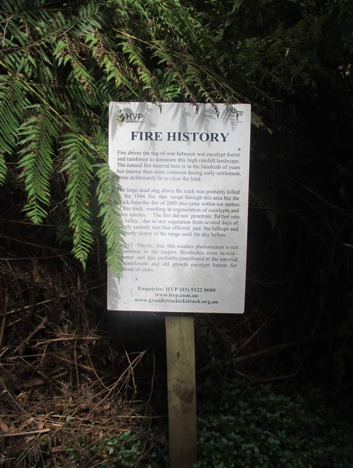
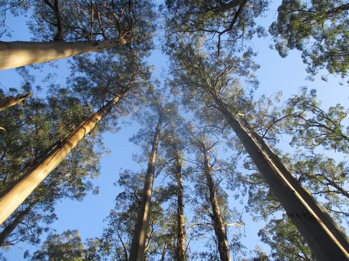
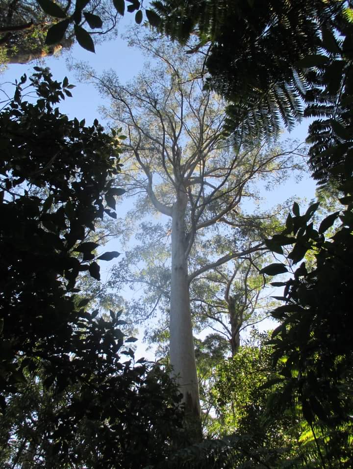
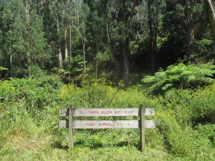
Crossing back over the main road, the Mount Tassie loop then followed the course of the excellent Duff Sawmill Heritage Trail, which meandered it’s way through some wonderful patches of cool temperate rainforest (the Merriman Creek section being a particular highlight) with many an interpretive sign illuminating both the human and natural history of the area. Interestingly, two-thirds of the Grand Strzelecki Track (a network of around 100km worth of old forestry roads and walking trails) passes through privately-owned land held by Hancock Victoria Plantations, who in addition to harvesting plantations for the timber industry also protect an area of native forest in perpetuity that far exceeds that of the adjoining Tarra-Bulga NP. Indeed, if it weren’t for the assistance of HVP (and the forestry road maintenance they carry out) the Grand Strzelecki Track could not exist in it’s present form.
After a short section of gravel road and a steep climb up to the north, I soon passed by the various television transmission towers crowning the summit of Mount Tassie, which at 754m is the highest point in the Strzelecki Ranges. If only some moron hadn’t pinched the table tops and seat tops from each of the picnic tables at the mountaintop picnic area I might have been able to enjoy my lunch with a grandstand view out over the broad agricultural/industrial plains of the Latrobe Valley, but as it was I managed to find shelter from the breeze for my little portable stove behind the summit cairn and, in any case, the air was a little too hazy to truly appreciate those postcard-worthy views anyway.
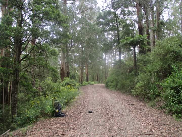
Pressing on with a full stomach straight down the northern slopes of Mount Tassie, I crossed the main road one last time before plunging down the Pine Trial Track, which then led to the gently undulating curves of the West Face Track, which contoured it’s way along the forested slopes of the range while offering views down over the Traralgon Creek valley. While the temperature by now had risen to the mid-twenties, the walking was easy and the kilometres ticked by effortlessly, until soon after visiting the secluded nook of Forget-me-not Falls I turned onto Drysdale Road (another rarely-used forestry road) and tackled the initially steep uphill grunt back towards Balook. A short jaunt back down the Telecom Track (where only the most enterprising – or perhaps foolhardy – spiders had already re-woven their webs, in the aftermath of my morning trail of destruction) and I was back in Balook; though unfortunately I wasn’t able to purchase a set of hiking maps for the Grand Strzelecki Track as the National Park visitor centre was closed… as was the cafe across the road! Oh well, I hadn’t really wanted an iced coffee or a slice of cake anyway… or at least that’s what I told myself as I set out back along the Grand Ridge Road to my campsite!
Having sent a quick email to Richard (the esteemed administrator of this webpage, and one of the driving forces behind the Grand Strzelecki Track) enquiring into current conditions on a couple of other sections of track that I intended to walk in the coming days, I was preparing an afternoon meal when suddenly a visitor appeared at the rest area… and lo and behold, it was Richard! Handing me a free set of hiking maps and answering all of my questions (it was he who tipped me off about the Strzelecki Burrowing Crayfish) he explained that the National Park visitor centre was staffed entirely by volunteers – of which they had recently had a shortage – but that a new batch of volunteers had been trained up and were just about to be let loose on the general public!
I could only express my admiration for the dedication that he and others in the local community have shown, to not only get the concept of the Grand Strzelecki Track up and running in the first place, but to continue to maintain and promote it as a way of attracting people to what is truly a beautiful – yet vastly underrated – destination. I also couldn’t help secretly (and somewhat selfishly) being thankful that both the Track and the surrounding region aren’t more popular – I mean where else can you spend day after day exploring a mountain range cloaked in rainforest on a clearly-marked and well-maintained trail network; with comfortable, well-located (and free!) campsites provided by the local community; and without having to encounter crowds of people to do so, even during summer school holidays?!?
Chapter 3 – Day 3
With the beautiful weather still holding out all across Gippsland, I tackled another full-day loop on my third day in the Strzelecki Ranges – this one being the Tarra Valley loop, which with a couple of add-ons ended up being my longest day yet, at around 26km. The only problem with that was that with ear plugs in (to block out the noisy resident possums at Pattison’s rest area) and a perfectly-placed tree shading my tent, I ended up sleeping in until nearly ten o’clock! Still, with the sun not setting until 8:30pm I figured I’d have more than enough time, and having already seen just how beautiful the Tarra Valley was from my walk/hitch-hike in I couldn’t wait to explore it in more depth.
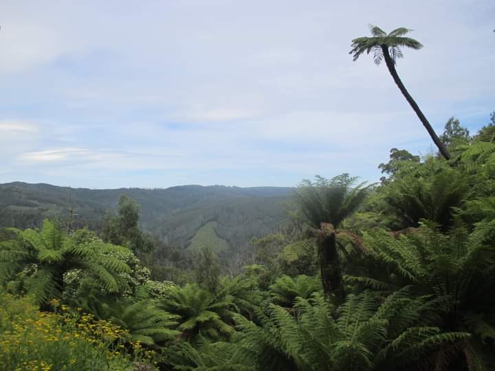
But first I had to get there, which involved heading down the delightfully forested Goombala Road to the Mountain Hickory Track, which then led me to Tarra Valley Road… only to immediately farewell the sealed road on the short but seriously steep climb up Duncan’s Track. After gaining the ridge-top there followed a wonderfully undulating walk along Butler’s Track, where a tiger snake posed thoughtfully in dappled sunlight as I clicked away on my digital camera, only moving it’s head ever-so-slightly to track my progress as I passed. Eventually I joined the aptly-named Great Forest Walk, which after contouring around the upper slopes of the valley then plunged headlong straight down into it’s depths, and it was here that I saw two couples coming up in the opposite direction – the first people I had encountered on any of the tracks since my encounter with the lyrebirds two days earlier! Did I mention this is the ultimate destination for solitude seekers?!?

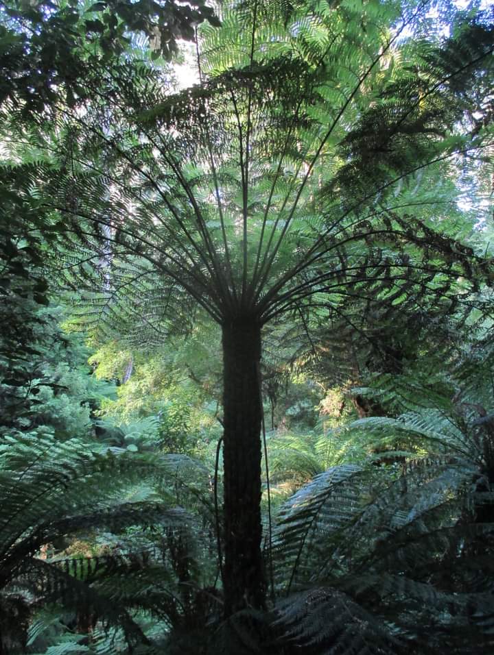
Emerging from the bush at the Tarra Valley picnic area – where the twenty or so parked cars represented the closest thing to a crowd I would encounter in five days – I was soon ushered back into the cool, lush embrace of a tree fern paradise. A century ago the local community led a campaign to have this small slice of the valley protected in what became known as Tarra NP, named after Charlie Tarra – an aboriginal man who guided Strzelecki and his explorer companions on their first expedition through the region. This was not long after Bulga NP had been declared, at the crest of the range where the visitor centre now stands, which had itself been named after a local indigenous word for ‘mountain’. And it was the joining – and subsequent enlargement – of these two protected area that led to the present day Tarra-Bulga NP.
Delaying my lunch break for just a little while longer, I explored this lovely little green haven on the short Rainforest Walk, which led me through a treasure trove of slender tree ferns and past the lovely cascade of Cyathea Falls, before depositing me back at the picnic area where there was no shortage of picnic tables (this time with all parts present and accounted for) tucked in between the ferns beside the infant Tarra River. Never have teriyaki rice out of a packet and instant mashed potato tasted so good! The peace and serenity of that spot was truly captivating.
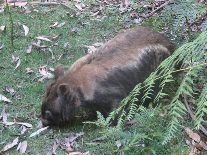
But with time ticking away and only a third of the day’s walk behind me I eventually managed to break free of the spell that enchanting little pocket of rainforest had cast over me, so after detouring a few hundred metres down the road to see the river tumbling down the extended rock slide of Tarra Falls, I headed back into the Bush on the curiously-named Diaper Track. Again my ‘spider web stick’ proved it’s worth, as the track slowly but surely led up and out of the Tarra Valley before passing through a section of recently-harvested plantation forest just outside Balook. No sooner had I re-entered the national park than I encountered a wombat with a unique and rather eye-catching two-tone colour scheme on his fur, so naturally I approached quietly and was able to get within a few metres of the furry little lawnmower before it noticed me and darted into the nearby scrub.
But if I thought that would spell the end of our encounter I had another thing coming, for after indulging in a particularly vigorous scratching session the wombat immediately re-emerged from the bush and proceeded to come ever closer. Now having seen a number of wombats in Tasmania I had long since come to realize just how poor their eyesight is, and that by standing still and keeping quiet you can often have a wombat come quite close to you before it gets spooked. But this particular wombat was something else! Showing no fear whatsoever it proceeded to approach me and start sniffing at my shoes… only to then start nibbling at them!
Now don’t get me wrong, I like wombats very much, and would usually never intentionally come between one and it’s food. But I had paid two hundred dollars for those hiking shoes less than two months earlier and there was no way I was going to sacrifice them to a hungry wombat. So I took half a step back, only for my companion to creep forward and resume nibbling at my shoe. I took another half-step back, so my furry friend switched his attention to my other shoe. And it was only when I then took two full steps backwards that the wombat suddenly realized “oh sh_t, there’s a human standing there!” and immediately went barrelling off through the bush at top speed whilst snorting discontentedly! They may be endearing creatures, wombats, but keen-sighted or intelligent they are most certainly not!
After all of this excitement I soon emerged beside the visitor centre in Balook, where a brief rest and a snack had me ready to tackle the final third of the loop. So after reversing the last three kilometres of yesterday’s walk along the Telecom Track and down Drysdale Road – where the forested flanks of Mount Tassie where illuminated by the late afternoon sun, while the heavy bulk of Mount Baw Baw could just be seen brooding way off in the distance – I then had the supreme good fortune of being able to walk the undulating curves of Goombala Road through the cool shade of the forest, while the hillsides all around were bathed in golden light. What a magnificent end to a magical day!
Chapter 4 – Day 4 and 5
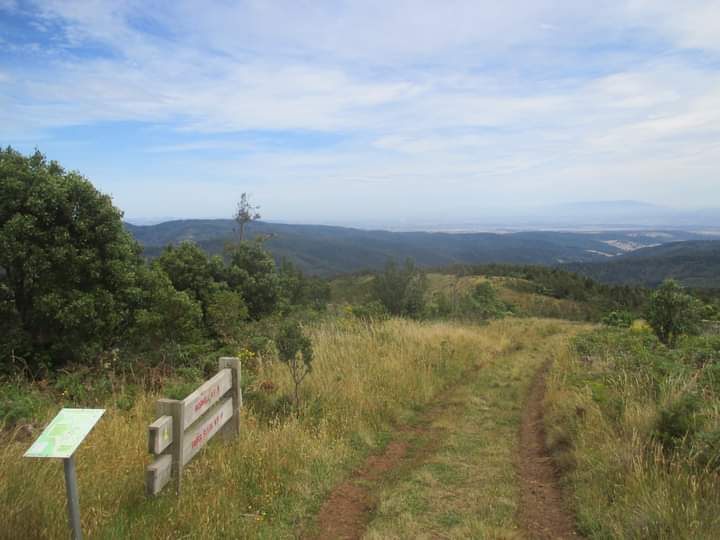
After three nights at Pattison’s rest area outside Balook, it was time to pack up the tent and hit the trail for the two-day walk to Churchill down on the plains. And despite the extra weight on my back the walking was relatively easy, following a couple of the less creatively-named roads in the area (Road 57 and Road 31) for most of the way. The first half of the day was a gradual descent from the crest of the range down into the Traralgon Creek valley – with views of forested mountainsides stretching off in every direction – before tackling the equally-gradual climb up the other side.
Only when I was within about a kilometre of the finish line for the day (Jumbuk rest area) did the route leave the forestry roads behind to head off into the bush on a narrow walking trail… and almost immediately the easy going nature of the walk changed. About fifty metres in a sign warned that the trail had been realigned and to watch carefully for trail markers – the only problem was that the trail then disappeared completely before I was able to locate any! Try as I might I could find no sign of the trail up ahead, and while I could just make out a few faint footpads heading off in different directions through the bush, each attempt to follow these tantalising traces of trail would end with me getting completely tangled up in the impenetrable scrub, as cuts and scratches started stacking up on my arms, legs and neck!
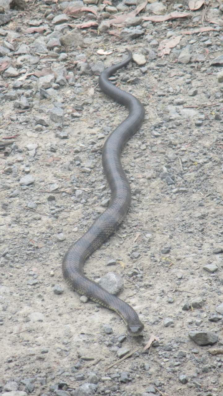
Eventually I was forced to admit defeat, at which point the only option was to backtrack (all of about fifty metres!) to the road and follow it around to the rest area instead. But this soon had an unforeseen benefit, as not only did it take me past a beautiful little man-made reservoir surrounded by ferns and populated by ducks; but then just a short way up ahead I was greeted by the sight of a tiger snake sprawled out full length across the road, clearly enjoying the dearth of traffic as much as I had.
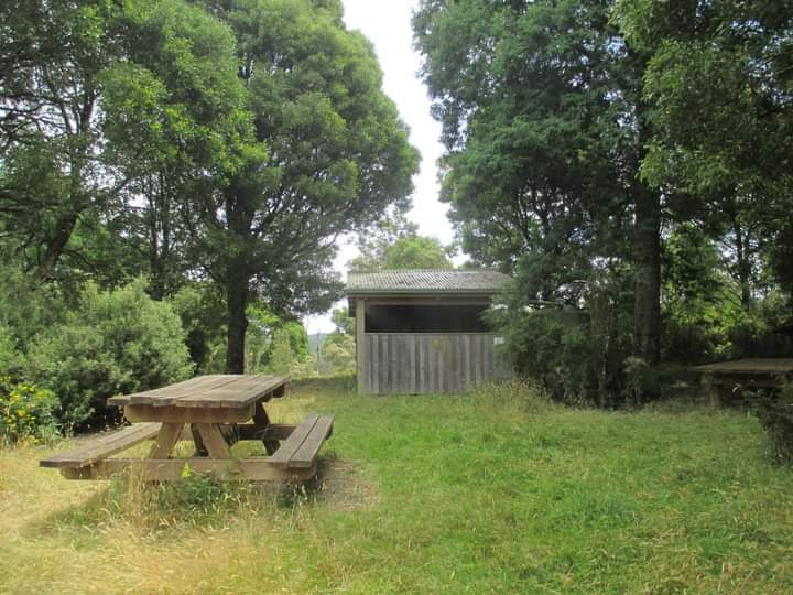
Soon enough though I arrived at the Jumbuk rest area, which just like the one outside Balook had a picnic table, rainwater tanks and composting toilet – though this one also had a roofed shelter with enough space to accommodate three tents underneath in case of bad weather; as well as a number of timber platforms scattered around the cleared area that would serve perfectly well as a table or perhaps even a tent platform. For a free campsite, it certainly contained every possible convenience – another great resource for hikers on the Grand Strzelecki Track to have at their disposal.
With the forecast for the following day hitting forty degrees down on the plains, I was up with the sun at six o’clock to try to beat the worst of the day’s heat by hitting the track as early as possible. And thanks to Richard’s information about the remainder of the track through to Morwell NP (about five kilometres from the town of Churchill, from where I would be catching a bus to the nearest train station) being somewhat overgrown at present, I had decided to take the easier (if technically longer) way out by simply following West Jeeralang Road all the way down onto the plains instead.
Thankfully the weather wasn’t totally against me though, as for the first time since I had arrived in the mountains there was both a decent layer of cloud cover to shelter me from the sun, and a consistent breeze to keep me relatively cool and dry. Combined with an enforced ten minute rest break every hour, this meant that I never overheated or became overly exhausted, so that the walk passed by without any of the heat-induced suffering that I had spent the previous couple of days mentally preparing myself for!
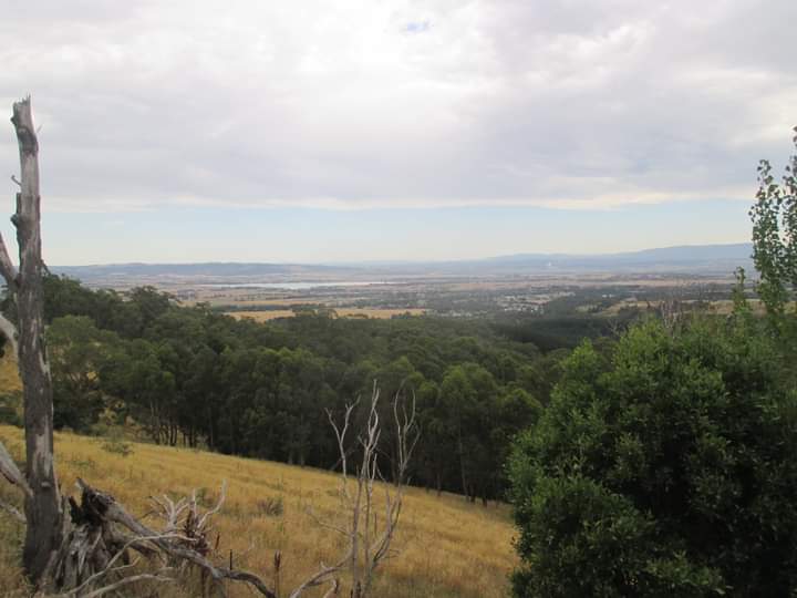
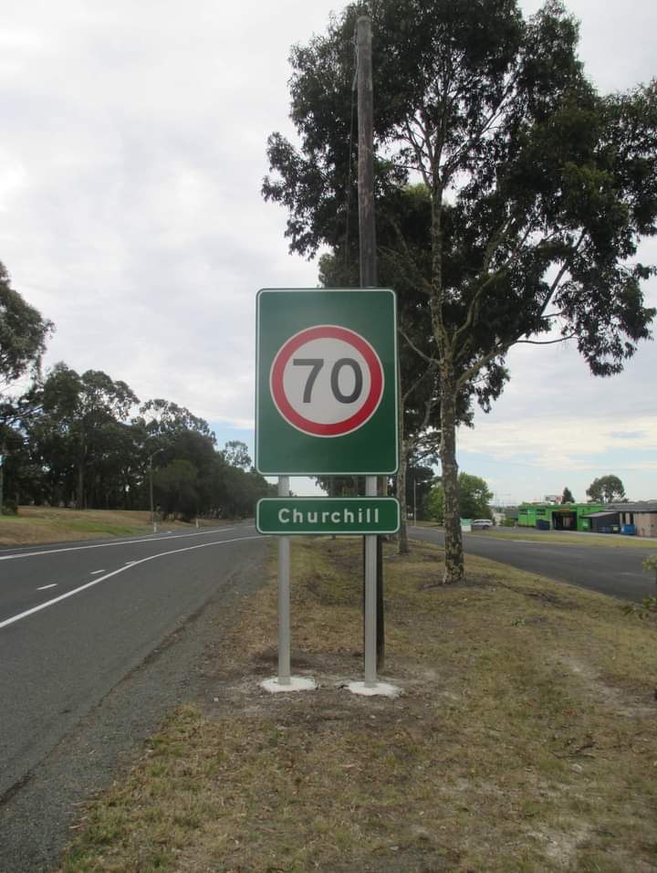
For the first couple of hours I simply wandered along, gazing at the forest lining both sides of the road, until eventually I emerged on the northern flanks of the range where I got my first views of the flat, agricultural/industrial heartland of the Latrobe Valley… views that would accompany me the rest of the way down to Churchill. And with a final flourish (in the shape of the Giant Cigar – which serves as Churchill’s number one landmark and main claim to fame) my walk came to an end at the bus stop in the centre of Churchill.
All in all I covered about 100km during my five days in the Strzelecki Ranges, about two-thirds of which was along the network of tracks and trails incorporated into the Grand Strzelecki Track. It wasn’t just the scenery that had made an impression on me, but the prevailing atmosphere of peace and tranquillity accompanied by a total absence of any sort of stress… I could simply pitch my tent without having to worry about booking or paying for anything, then hit the trails for as long as I liked each day – and all without having to worry about dodging any crowds.
But as satisfied as I was with my time in the region, there was still one thing gnawing away at me as I sat waiting for my bus in Churchill. According to my generously donated five-piece hiking map set, I had only completed three of the five sections that make up the Grand Strzelecki Track; which meant there were still two sections left: the Macks Creek Loop and the Billy’s Creek section (from Jumbuk through to Morwell NP) of the Park to Park Track. Oh well, guess I’ll just have to return to the solitude and serenity of the Strzelecki Ranges’ magnificent mountain ash and tree fern-filled forests sometime in the future then…
Thank you Matthew for sharing your experience.
Story and images with permission by Matthew Hassam.
http://www.mytb.org/backpackermatt